Rating the Trails with my Jimny and my boys: Tswaing Meteorite Crater 2014

The Pretoria Crater (Tswaing meteorite Crater)
Open Monday – Sunday 07h30 – 16h00
DITSONG: Tswaing meteorite Crater Plot: 149 JR Soutpan.
Tswaing is situated on the M35, Soutpan Road. For more info: 012-000-0010 or 076 9455-911
We got up really early and made a cappuccino stop first then
headed off to our next adventure. Today we would be exploring a meteorite
crater. I have wanted to visit this place for nearly 20 years and for one
reason or another it had not happened until now! Jordan and I were really very
excited. The little Jimny Jeep was packed, loaded and ready to roll into adventure! It had rained heavily all
night in Johannesburg and we were not sure what terrain awaited us, so together
with our trusty First Ascent Trekking poles and Gaiters that were invaluable
during the 9 Peaks challenge earlier this year, we headed for the hills.

 I was thrilled to find the Tswaing Crater Museum under
Places of interest in my GP! We had to drive a full 74km from Randburg to the
crater. Awesome, we did not have to wing it today. The GPS took us through
Pretoria past the central prison then off to Visage street and out onto the
M80. We drove in intermittent drizzle.
Finally we drove through the Soshanguve Township. The main road runs straight
through the township and we passed a fire engine and police cars, where a bumper
bashing had occurred. It took a little negotiation to bypass all the congested
taxis at the 4-way stop street. The street is neat until you pass a rubbish dump
where plastic bags have been blown onto the fences. We also passed a large community centre on
the right side of the road that also has a clinic. There are many single shacks
set up on large pieces of land. I wondered how many vegetable gardens could be
started there!
I was thrilled to find the Tswaing Crater Museum under
Places of interest in my GP! We had to drive a full 74km from Randburg to the
crater. Awesome, we did not have to wing it today. The GPS took us through
Pretoria past the central prison then off to Visage street and out onto the
M80. We drove in intermittent drizzle.
Finally we drove through the Soshanguve Township. The main road runs straight
through the township and we passed a fire engine and police cars, where a bumper
bashing had occurred. It took a little negotiation to bypass all the congested
taxis at the 4-way stop street. The street is neat until you pass a rubbish dump
where plastic bags have been blown onto the fences. We also passed a large community centre on
the right side of the road that also has a clinic. There are many single shacks
set up on large pieces of land. I wondered how many vegetable gardens could be
started there!


Finally on our left we came across the entrance which seemed
to suddenly creep up on us. it is quite a grand entrance in comparison to the
environment we had just driven through. The security guard was very friendly
and helpful and we made our way to the main reception area. I was devastated to discover that the museum
had burnt down some 5 years ago and until now no effort to rebuild it had been
made. It made me really angry that this had been left for so long.


We parked the Jimny then walked into the reception where we
were met by a very friendly and knowledgeable man called William. We paid William our R20 each and he gave us
some great brochures. William is passionate about the Crater and soon we were
armed with some fantastic information a map of the trails. William told us
that 5 years ago the Museum and other buildings burnt to the ground during a
hectic veldt fire. He said the fire department could not stop the fire due the
strong winds and helped to save the main buildings.

This meant the beautiful
museum and other important buildings were raised to the ground remaining a sad
and stark reminder of so many possibilities for both the immediate communities
and to all the young minds eager to learn. William told me budget had been
approved so I am hoping this means it will be rebuilt, especially for William’s
sake he is really passionate about his work.

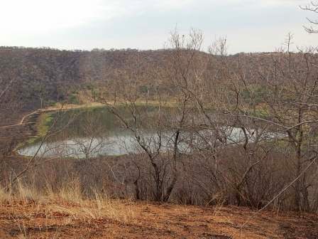
Around 220 000 years ago a blazing stony meteorite of about
50m in diameter entered our earth’s atmosphere and slammed into the earth’s
crust. The resulting impact created a huge crater 1,13km in diameter and
initially 200m deep.
This awesome cater was known as the Pretoria saltpan (or
Zoutpan) and its is found 47 km north of the Pretoria CBD. It is one of the
best-preserved terrestrial meteorite impact craters in the world. And it is in
our back garden people!! Tswaing also has a saline lake which is fed by an
underground spring. This is evident when you sit at the lake and watch the
current and movement of the water which is clearly visible on the water
surface.

The name Tswaing I found out means Place of Salt in
Setswana. As far back as the Middle Stone Age (some 150 000 to 30 000 years
ago) lived small nomadic groups of people who started to hunt game, gather
edible and medicinal plants and collect the salt. Iron age people lived close
to the crater about 800-900 years ago, tending their cattle, growing crops and
collecting salt from the crater floor. Evidence of early people and the salt
mine which operated at Tswaing between 1912 and 1950 can still be found.
Today Tswaing is a heritage site making up a 2000-hectare
conservation area with a focus on the conservation of the natural and cultural
heritage (mining, farming and oral histories) of the site. In local mythology
it is believed that a large snake lives in the Crater Lake and will eat anyone
who is near the lake at nights. The snake stores the bones of its victims in a
cave on the hillside.

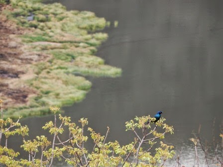
Major attractions, besides the crater are an extensive
wetland system, herds of kudu, impala, hartebeest and zebra and other animal
species like vervet monkeys, mongoose and a variety of reptiles, amphibians and
insects. A large variety of plant species and the 240 odd species of birds
making it one of the best birding spots in Gauteng. The 7.2 km Tswaing Crater
Trails is one of a few meteorite crater hiking trails in the world and offers
the visitor a full perspective of the craters beauty,
You are able to book guided tours and walks for groups by
prior arrangement with the staff. In the reception area is a small display is
set up.

Tswaing Crater trails is one of
the few meteorite hiking trials in the world which takes you to the crater
floor. The duration of the walk is about 3 hours. The more difficult parts of
the trail are those sections going into the crater and back up. The interesting
points along the route are marked with and explained by signboards.

The brochure states: “Remember Twaing is a sensitive and
unique conservation area for the careful and sustainable management of its
multiple cultural and natural heritage resources in the disciplines of geology,
the environmental sciences, biology and human history.
Strong emphasis is
placed on the protection and use of the area’s natural and cultural heritage
for research, environmental education, recreation and community empowerment.
This is achieved in close consultation with local communities, scientists,
conservation agencies, private sector business and national provincial and
metropolitan government institutions.”

William told us that there used to be a lot of Eland herds
but they have a problem with poaching and you can see where the fence has been
damaged. It would be really great to get
system and partnership with the
immediate community as they have done so in the Kruger National Park. If the
park could increase its visitors, tourism and school group visits this may lead
to some type of job creation for the locals. We need to have systems in place
to educate and involve the communities or they will continue to poach the game,
they are hungry.
 The brochure also mentions that facilities are for fire from meetings, promotions an d conferences and other special events. There is also overnight accommodation The area is also for hire for commercial film locations.
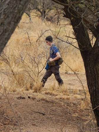
Our adventure begins.....
 Once we left the office we drove along a dirt road over a low level bridge to watch a troop of vervet monkeys playing around near the river. The road is accessible to cars, I would imagine if there was heavy rain it would be muddy and a little bit of a challenge. We did experience a little mud much to Jordan’s delight and put the Jimny jeep through its paces enough to get mud all over the car!!


We crossed over a small bridge over a river that was flowing strongly due to the rain and came across a small troop of vervet monkeys who were only too happy to stop and stare at us and I managed to get some really great shots of them with my new Nikon camera.


 We arrived at the gate and met
the Douglas the friendly security guard.
He informed us we could park anywhere.
There were clean looking loos and showers, just no toilet paper. But I
always bring my own along so it was not big deal. Douglas then explain a few house rules,
checked our day permits and explained where the trail started and the various
trail options we had.
We arrived at the gate and met
the Douglas the friendly security guard.
He informed us we could park anywhere.
There were clean looking loos and showers, just no toilet paper. But I
always bring my own along so it was not big deal. Douglas then explain a few house rules,
checked our day permits and explained where the trail started and the various
trail options we had.


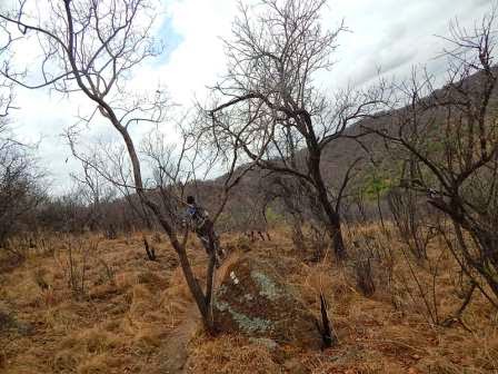
Unfortunately there had been a recent veldt fire which
William had told us about. He said that normally it would be really beautiful
and green with many of the wild flowers showing of their beauty. Well it just
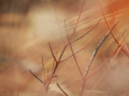
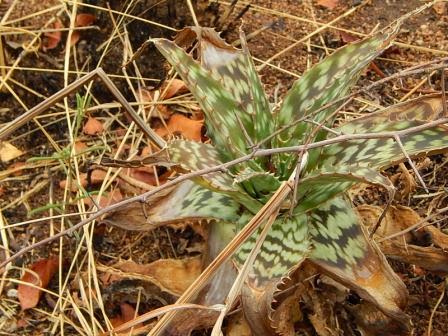
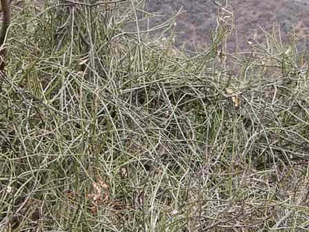
meant we would have to come back to capture the colours. Non the less the park is really stunning with
many different trees, shrubs and grasses creating a kaleidoscope of browns,
oranges, greys and some reds. It kept on drizzling inimitably but other than
that it was perfect hiking weather.


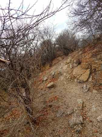
The
path is well marked and easy to follow. The map is simple and effective. We opted to start at 1 and end at 20.
Stop 1: to the right (east) is an open space where the old
cattle pens (kraal) of the former Zoutpan research farm used to be.


Stop 2: Remains of a trench that carried the main pipeline
between the crater and the soda and salt reduction works (site 19), through
which saline liquid flowed that was pumped from the crater.


Stop 3: Foundations of the residence built in the 1940s for
the Mine Manager of SA Alkali Ltd., the company that mined soda and salt at
Tswaing between 1912 and 1956.


Stop 4: Crater viewpoint with a Morula tree. Due to changes in the slope angles of the crater rim and in the soil types and nutrients broadleaved woodland trees cover the upper slopes and thorny trees cover lower slopes of the inner carter rim.


Stop 5: Crater rim cutting, named after W Mauss who designed
the reduction works.
It carried the pipeline that pumped back waste liquid
remaining after the extraction of soda and salt, back into the Crater Lake.


Stop 6: Crater viewpoint with foundation of another building.


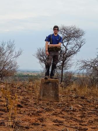
Stop 7: one of the concrete survey beacons erected in 1953 to demarcate the mining area.
(no number) Viewpoint: Granite plaque named after and commemorating Dr Eugene Shoemaker, an American geologist who pioneered the study of meteorites and their impact.


Stop 8: The Tswaing Crater is a bowl-shaped geological
feature, caused by the impact of a 50m chondrite (stony meteorite) 220 000
years ago, which exploded and vaporized on impact. The crater can host four
simultaneous football matches and half a million spectators.


Stop 9: at Shoemaker Viewpoint you are 60m higher than the
surround landscape and 100m above the crater floor. The distance to the opposite
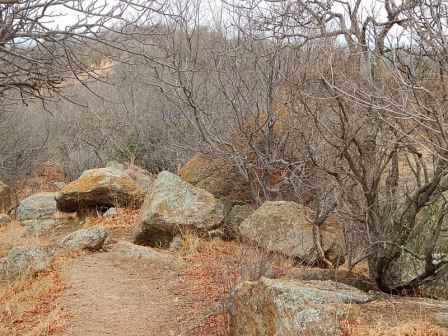
crater rim in 1.13km.
You are standing on top of large granite boulders that
were ejected by the force of the meteorite impact. There is quiet a steep drop
below.


Stop 10: these granite boulders sow how weathering (breaking
up into small fragments) by lichens takes place. Lichens are minute organisms consisting
of algae and fungi living together.


Stop 11: stone tools and weapons, dating back to the Middle
Stone Age period have been uncovered here, showing that as far back as 150 000
to 30 000 years ago people came to Tswaing to hunt, gather edible plants and
collect salt.


Stop 12: Segment of dyke consisting of igneous (volcanic)
intrusive rock known as lamprophyre. This rock was present before the impact.


Stop 13: Research boreholes made back in 1972 by Pratley
Company (pressure tap used to collect water for medicinal purposes), 1988-1989
(hidden) and 2001-2002. The 1988-89 and recent boreholes explored the sedimentary
deposits below the present crater floor.
it was at this point my batteries of my new camera died and I used my cell phone camera to capture the rest.!


Stop 14: The Crater Lake water originates from surface
springs, underground water and rainwater. Because the lake is rich in dissolved
carbonates and chloride salts, predominantly of sodium (originating from the
soils and groundwater), it was mined. The sulphurous smell emanates from
bacteria in the lake.


Stop 15: close to the road, made for ox wagons in the 19th century, is a place where Sotho- and Tswana- speaking communities produced slat by filtering boiling and evaporating the lake water during AD 1200-1830. They left behind many fragments of clay pots that disintegrated during this process.


Stop 16: remains of central pumping station from where the
saline liquid, collected through many boreholes (visible above the lakes
surface) was pumped over the crater rim to the reduction works.


Stop 17: section of crater rim showing granite that was
folded, displaced and overturned as a result of the impact.


we decided to walk off course from site 16 and 17 and head up a steep gully to give us some exercise. We made our way up and over the crater rim and turned right at a small dirt road. We ended up walking the outer rip twice and the inner rim once. We completed this with many stops, tons of photographs in 4 hours. it was good to push the legs a bit and create our own little challenge.
We then trail ran for some time and I got a large thorn that went through the sole of my boot and into my foot. Eina!! I was very brave and let Jordan pull it out without a scream, but it burnt and stung like a son of a gun. My son's advice lets run it off Mom!! I was getting a taste of my own medicine! it worked after about a kilometre the pain was gone!
Stop 18: whitewash, used in an unsuccessful attempt to
change the colour of salt, briefly produced in the 1960’s from brown to white.


Stop 19: Ruins of the reduction works where the saline
liquid from the crater was transformed into soda ask and salt between 1922 and
1956. The sign says: beware of snakes and hidden underground reservoirs!!


Stop 20: These ponds, part of the reduction works, used to
store and warm up the ice-cold saline liquid left over from the soda production
process, before salt was extracted from it.


 We made our way back to the car park along the dusty road
when Jordan suddenly leapt into the air. He shouted “snake” and suddenly this
small and beautifully marked snake with its black and white stripes was moving
sideways at a rapid speed across the sand straight towards me. I got out of its
way without any hesitation and managed to get a shot of it as it raced of into
the grass. Jordan was very lucky as he leaped in the air it tried to strike his
boot but missed. All Jordan could think about was a story a mate, Kobus Bresler
had told us during the nine peaks adventure. He had had a snake strike his boot
and the poor thing then became “stuck” on his boot. Luckily nothing quiet as
freaky happened to us. Jordan was trilled he now has his own hiking snake story
to tell around the camp fire.
We made our way back to the car park along the dusty road
when Jordan suddenly leapt into the air. He shouted “snake” and suddenly this
small and beautifully marked snake with its black and white stripes was moving
sideways at a rapid speed across the sand straight towards me. I got out of its
way without any hesitation and managed to get a shot of it as it raced of into
the grass. Jordan was very lucky as he leaped in the air it tried to strike his
boot but missed. All Jordan could think about was a story a mate, Kobus Bresler
had told us during the nine peaks adventure. He had had a snake strike his boot
and the poor thing then became “stuck” on his boot. Luckily nothing quiet as
freaky happened to us. Jordan was trilled he now has his own hiking snake story
to tell around the camp fire.
and so ended our awesome Meteorite Crater hike and we cant wait to go back once it is greener....
contact me if you would like me to take your school group on a crater adventure.....


